Map & Globe Skills
The ability to properly read maps and globes gives you an opportunity to explore different places, people, and cultures in the real world. These resources, teaching tips, and ideas will help make it easy for your children to learn to read and understand maps and globes.
Activities & Experiments

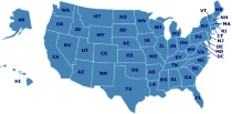
Great States Board Game
What is the capital of NJ? Where is the Football Hall of Fame? These are just a few of the hundreds of questions players are asked as they adventure around the USA discovering state attractions and landmarks, capitals, state abbreviations, state locations and more. In order to answer the questions on the cards, players must look closely at the colorful USA map game board, becoming familiar with the geography of the country. Players must hurry to find the answers as the mechanical timer ticks. Contents: Game board, 100 Figure cards, 100 Fact cards, 100 Find cards, 1 spinner, 1 mechanical timer, and game rules. Duration of Play: 20 minutes. 2-6 players.

Name That Country Game
"Dear Pen Pal, Konnichi wa! We've been to see Mt. Fuji. Name my country! Sayonara, Michiko." Challenge your group with this fast-paced geography game, created in 1992 by Educational Insights, Inc. Everyone begins at the post office. Players twirl a finely printed spinner (built into the game board itself) to select one of 60 countries. If the player can correctly identify the country's location on the board's numbered map, he or she may advance along the path to the finish. Bonus moves are won by landing on "postcard" spaces, listening to the clues on one of the 40 postcards, and correctly identifying the pen pal's country. (The sample postcard above came from Japan.) A more challenging game can be achieved by requiring players to name the country's capital; answers are provided. --Liane Thomas
Postcard Kids
Geography Postcard Kids Project started for homeschooled children around the world in October of 2002. It is intended to help enhance geographic studies by sending postcards from their local area to other postcard kids around the world.
Teaching Tips & Ideas
Knowledge Quest
Knowledge Quest offers historical outline maps and timelines designed for the interactive study of world history and geography.
How I Teach a Large Family in a Relaxed, Classical Way: History
A look at teaching history across several grades using the classical method of education and a rotation of history every four years.
Looking for Another State?
Featured Resources
As an Amazon Associate, we earn from qualifying purchases. We get commissions for purchases made through links on this site.

Different Brains, Different Learners: How to Reach the Hard to Reach
Nearly 40% of all students have some kind of learning challenges, yet many go undetected. This practical comprehensive guide has been written that links the latest brain research with teaching strategies to reach you most frustrating, hard-to-reach learners. It's packed with powerful tools, techniques, and strategies that can actually help students improve brain function without resorting to medical interventions.Arm yourself with powerful knowledge for solving difficult learning problems; ...

Serving Homeschooled Teens and Their Parents (Libraries Unlimited Professional Guides for Young Adult Librarians Series)
This guide for librarians addresses the needs of homeschooled teens and how a library can meet those needs. Includes ideas like developing a homeschool resource and book collection to creating special homeschool programs. While this book was written for library staff, it is also an insightful guide into how homeschoolers and libraries can work together.

Christian Unschooling : Growing Your Children in the Freedom of Christ
Is unschooling incompatible with Christianity? Elissa Wahl and Teri Brown argue that they are not incompatible, but complementary. Unschooling offers a different path to learning. This book explains what unschooling is (and isn't) and offers support for your unschooling journey. Includes information and support, along with essays on how they unschool guided by the Lord.

Home Schooling from Scratch : Simple Living, Super Learning
Parents learn what they really need, how to find or create materials and opportunities for less money, and how to organize their household for economical, happy learning.

When Children Love to Learn: A Practical Application of Charlotte Mason's Philosophy for Today
Children want to learn and one of the best approaches to homeschooling is to meet their natural curiosity with support and understanding. Charlotte Mason's educational philosophy does just that. This book offers explanations of how to incorporate Mason's ideas into your teaching, leading to more success in learning and less frustration in the home education environment. This book is a great resource for those embarking on the homeschool journey, as well as being an invaluable resource for those ...